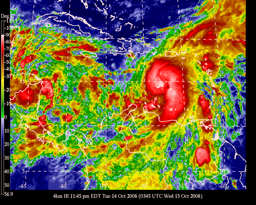
Huracán Omar / Hurricane Omar

How to read this map Severe Weather Outlook National Forecast
GOES-East Caribbean 4km Infrared
11:45 PM EDT Oct 14 2008 0345 UTC Wed Oct 15 2008

Select Image Size: Thumbnail | Standard | Large

Model Overlay: On | Off

Select Animation Style: Java | Build Gif

Switch Satellite: GOES-West | GOES-West Mosaic | GOES-12

How to read this map Severe Weather Outlook
GOES-East Caribbean 4km Infrared
11:45 PM EDT Oct 14 2008

Select Image Size: Thumbnail | Standard | Large
Model Overlay: On | Off
Select Animation Style: Java | Build Gif
Switch Satellite: GOES-West | GOES-West Mosaic | GOES-12
| Menu of Text Products for the Hawaiian Islands and the Tropical Pacific/Atlantic Oceans: Narrow the Menu List Select Time Limit: 12 hours | 24 hours | 48 hours | 72 hours | No time limit Select Product Type: All | Routine Bulletins/Forecasts | Warnings/Watches/Advisories | Hawaiian Weather | Tropical | Marine | Aviation Products | Daily Observations | Special Messages Atlantic Tropical Weather Outlook 581 |
No comments:
Post a Comment